Crossing the creek near Tannery Dam
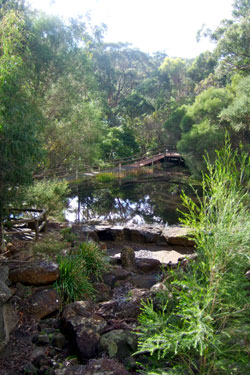
The lake at Ballarat Bird World
Ballarat Bird World Circuit Walk
Walking Notes
(Hold mouse over brown text to bring up background information for the various points of interest)
1. Walk through De Soza Park, following the path to the rear, passing the poppet head on your right. To your left is a well, the original shaft of the Crown Mine [1]. Continue along the gravel track crossing Winter St, then along the left bank of Union Jack Creek.
2. The first vacant block on the left is the site of the Old Burial Ground [2], the first Buninyong Cemetery. A further 300m on, you are walking through what was the Tannery Dam. The original site of the Buninyong Tannery [3] is on your left, part of which has been built over. Proceeding along the track you are walking through where the Tannery Dam [3a] was situated. The dam wall was just west of the bridge across Union Jack Creek.
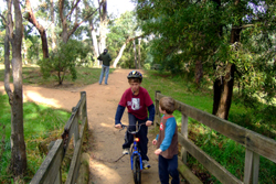
3. Turn right over the bridge then continue straight ahead till you reach Lumeah Rd. Turn right and follow Lumeah Rd up the hill past Hitchcock Rd where the route becomes a gravel road through bushland. This section of road in not open to vehicles. Walk past the two barriers. A short distance on is Ballarat Bird World [4]. Bird World is open from 10am to 5 pm and has one of Australia's largest displays of parrots ands cockatoos and is well worth the one-and-a-half hours visit.
4. Past Ballarat Bird World [4], the route changes to a sealed road, in what is known as Eddy Ave, in the suburb of Mt Helen. At the top of the hill is Moss Ave and you turn right, walking where possible on the right hand roadside verge. Continue along Moss Ave to the cycle track parallel to the Ballarat-Buninyong Rd. Turn right into the sealed cycle track and continue down the hill to Buninyong. As you will see from the signs along, it is part of the Bio-Link Trail that finishes at Union Jack Creek. This section is also part of the Goldfields Track, a joint walking-cycling track from Mt Buninyong to Bendigo.
5. Cross the bridge across Union Jack Creek. (Don't be confused if the Creek sign says Buninyong Creek. The name was changed to Union Jack Creek in 2009 and the Council is a little slow in changing its signs.)
6. Once over the bridge, turn right and follow the left bank of the creek down stream. The house block immediately on the left was the site of the Robbie Burns Hotel [5]. This section of track is scheduled to be fully constructed as a cycle-walking track for the Goldfields Track. If constructed, follow the Goldfields Track signs to Eyre St where the Goldfields track turns right. Instead, you cross the street and turn left along the sealed footpath over the creek. If not constructed, follow the Creek down to Barkly St, the first street that crosses the creek. Cross Barkly St to the left of the barrier then cross the creek turning immediately left to follow the track on the right of the creek to a wide grassed area at Eyre St.
7. Cross over Eyre St and turn left along the sealed footpath, crossing the bridge over the junction of Glencoe Creek [6] and Union Jack Creek.
8. Walk along Eyre St to Warrenheip St. On your left is one of the original shops in Buninyong know as Middleton's Store [7] where the first petrol pumps in Buninyong were erected. Opposite you is another original shop, originally known as Whykes' Grocers [8]. Turn right into Warrenheip Street where you walk past the Old Library [9] returning to your starting point, De Soza Park.